Keep a watch on weekend weather in Auckland as anniversary of floods approaches – forecaster
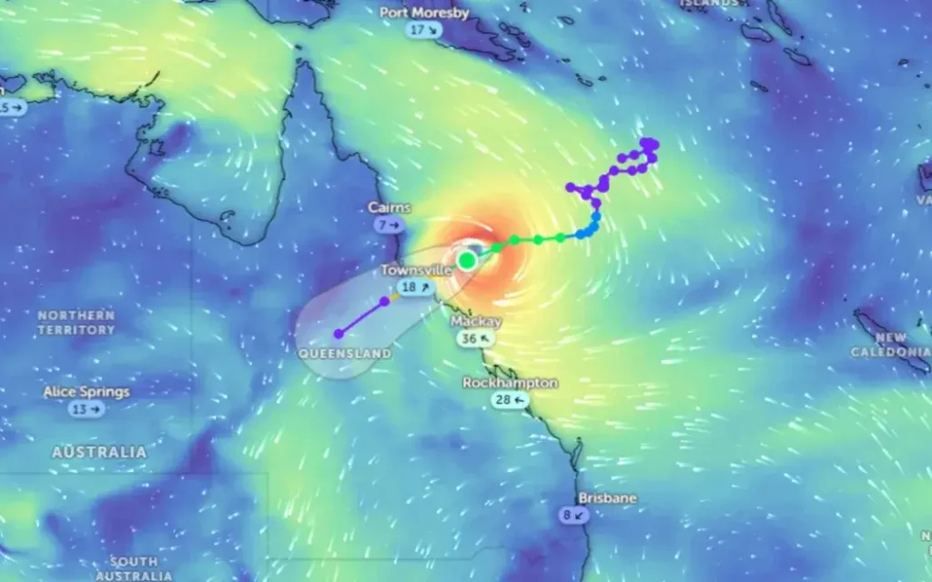
Weather Conditions: Cyclone Kirrily is bearing down on Far North Queensland and is expected to make landfall near Townsville on Thursday night as a category 2 storm.
It is likely to impact weather here in Aotearoa in the next week.
National Institute of Water and Atmospheric Research (NIWA) forecaster Chris Brandolino said Kirrily was presently at the lower end of the five-point scale.
“But nonetheless, tropical cyclones are known for producing flooding rainfall, likely to intensify… as it approaches the Queensland coast, probably crossing the coast – the centre of the tropical cyclone – sometime very late tonight or very early tomorrow morning near Townsville,” he told Midday Report.
“So that’s south of Cairns for those who have interest or know that area, and that’ll probably continue inland and weekend.
“But for Aotearoa New Zealand, we’ll have to watch maybe for some of the moisture associated with the remnants of the cyclone. There’ll be a separate weather system approaching from the west and south, and that weather system may actually tap into some of that moisture which would enhance the rainfall that would fall anyway.”
Australia’s ABC News reported Kirrily on Wednesday afternoon had winds up 130km/h, and was slowly moving southwest. Schools across the greater Townsville area have been closed, flights cancelled and residents told to stay home.
The expected rain on this side of the Tasman comes on the first anniversary of the Auckland Anniversary floods, which deluged parts of the city and killed four people.
“It’s tough to say exactly where the heaviest rain will fall, where the most rain will fall,” Brandolino said. “I can certainly understand people who may have a bit of in anxiety. I’m Auckland-based, I lived in and witnessed the flooding and the heavy rainfall first-hand like a lot of people.
“My message to Aucklanders and those in the upper North Island in general is to keep a sharp eye on the forecast. I think Saturday is probably the best day of the long weekend, as it stands now – that’s the best chance for pretty much dry weather.
“You’ll notice the humidity getting higher on Saturday, becoming more humid. Then Saturday night into Sunday we’ll see showers, thunderstorms increasing, and some of those could be heavy.
“And the threat for unsettled weather continues into Monday, so this is kind of a fluid forecast. Things will evolve in time, but certainly right now as it stands, not a complete washout – but there will be certainly periods of showers and thunderstorms, some of that could be heavy.”
MetService’s forecast for Saturday was heavy rain on the South Island’s West Coast and Fiordland, and perhaps Taranaki in the North. Severe gales were possible for the eastern half of the South Island and the Wellington region.
On Sunday, heavy rain was possible for the central and lower North Island, southern West Coast and Fiordland, while gale-strength winds were likely across the North Island.
On Monday, the rain was expected to have left the South Island, concentrating on central and lower North Island regions, moving to the East Coast by Tuesday.
With Thanks Reference to: https://www.rnz.co.nz/news/national/507524/keep-a-watch-on-weekend-weather-in-auckland-as-anniversary-of-floods-approaches-forecaster